(Part I of II) A recent West Virginia Weekend jaunt provided a chance to
test some new (and not-so-new) gear, and visit some lovely spots.
Part I: The Trip
Jeff and I hadn’t taken a bike trip since returning from our
eastern Canadian tour in June (blogs still in the works) so notwithstanding
forecasts that included scorching heat, thunderstorms, and other scattered
precipitation over most of the east coast, we were ready for another trip. Jeff picked West Virginia as the destination
most likely to offer the best mix of weather, given options ranging from “not
great” to “downright miserable.”
I was really looking forward to a hot weather ride because
at the end of last season, after too many trips when I just melted in my Klim three-season
jacket and pants, I had bought a light-weight mesh jacket and pants. After I
made the purchase, the weather immediately cooled off, so my new stuff has been
hanging in the closet waiting for August to roll around again.

 Saturday, August 11, started off cloudy. As usual, there was a lot of slab just to
escape metro DC, but after an hour or so we were in the Virginia
countryside. One of the weekend goals
was to reach the top of Spruce Knob, the highest point in West Virginia at 4,863
feet. It was a pretty ride. We went through part of the George Washington
forest, passing by Elizabeth Furnace. We
stopped at a little country store and gas pump (old-fashion
read-the-gallons-off-the pump-and-go-in-and-pay sort of place). The cashier insisted we should avoid Route 11
as it was the weekend for the Route 11 yard sale which she said would be a
mess. We admired the “black bear check
station” sign and the old fashion scale (for weighing your bear?) and grabbed
the geocache we came for. We did a bit
of Route 11 as planned and did indeed see many yard sales and flea markets, but
didn’t hit any of the traffic jams we were warned of. We passed through Harrisonburg and turned
west.
Saturday, August 11, started off cloudy. As usual, there was a lot of slab just to
escape metro DC, but after an hour or so we were in the Virginia
countryside. One of the weekend goals
was to reach the top of Spruce Knob, the highest point in West Virginia at 4,863
feet. It was a pretty ride. We went through part of the George Washington
forest, passing by Elizabeth Furnace. We
stopped at a little country store and gas pump (old-fashion
read-the-gallons-off-the pump-and-go-in-and-pay sort of place). The cashier insisted we should avoid Route 11
as it was the weekend for the Route 11 yard sale which she said would be a
mess. We admired the “black bear check
station” sign and the old fashion scale (for weighing your bear?) and grabbed
the geocache we came for. We did a bit
of Route 11 as planned and did indeed see many yard sales and flea markets, but
didn’t hit any of the traffic jams we were warned of. We passed through Harrisonburg and turned
west. The ride over the mountains was slow because we overtook a
number of bicyclists on a road with no shoulder and we were behind a truck with
a wide-load trailer. He couldn’t pass
any bicyclists without moving well into the on-coming lane, and the curves in
the mountain road offered few opportunities to do that. The bicyclists were strung out over a couple
of miles, so it was a slow and torturous climb.
The ride over the mountains was slow because we overtook a
number of bicyclists on a road with no shoulder and we were behind a truck with
a wide-load trailer. He couldn’t pass
any bicyclists without moving well into the on-coming lane, and the curves in
the mountain road offered few opportunities to do that. The bicyclists were strung out over a couple
of miles, so it was a slow and torturous climb.
Finally, we were able to get around the truck and then
quickly clear of the cyclists, so we were sailing until the rain started. We ducked under a gas station overhang so I
could pull on my rain gear (see more on this below) and Jeff could switch out
his gloves for waterproof ones and tuck his phone away. From our overhang, we
watched the pilot vehicle for the cyclists attempt to spray-paint directions
onto the road, but in the pouring rain, there was little chance it would last
long enough for the cyclists to read it. We left our gas station shelter and after a short drenching,
the rain cleared. We stopped at the
Germany Valley overlook, which was gorgeous.
 As we approached Spruce Knob, Jeff asked if I were game to go up. The road condition was uncertain, and it
wouldn’t have been much fun in the rain anyway, but at the time it looked
pretty clear, so up we went. It was a
reasonably easy ride up – a bit steep and twisty on a very narrow road, and
there was a bit of loose gravel, but overall it was fine. Lovely wildflowers on
the banks of the road. At the top there was plenty of parking and a 900-foot
easy walk to the overlook tower. We
climbed up and took photos. We also explored
a bit further down the trail – I think it was a ½ mile loop – but by then the
clouds were rolling in again and, as usual, motorcycle gear is not conducive to
hiking, so we cut the hiking short and headed back down the mountain.
As we approached Spruce Knob, Jeff asked if I were game to go up. The road condition was uncertain, and it
wouldn’t have been much fun in the rain anyway, but at the time it looked
pretty clear, so up we went. It was a
reasonably easy ride up – a bit steep and twisty on a very narrow road, and
there was a bit of loose gravel, but overall it was fine. Lovely wildflowers on
the banks of the road. At the top there was plenty of parking and a 900-foot
easy walk to the overlook tower. We
climbed up and took photos. We also explored
a bit further down the trail – I think it was a ½ mile loop – but by then the
clouds were rolling in again and, as usual, motorcycle gear is not conducive to
hiking, so we cut the hiking short and headed back down the mountain. 
 Despite the clouds, the rain held off. We had lunch at The Front Porch across from
Seneca Rocks. Our last trip to Seneca Rocks had been April 1, the last of the
seven Tour of Honor WV monuments that we had attempted that day. Seneca Rocks was a “daylight only” bonus on
that trip and we made it just five minutes before the end of twilight (see
earlier blog) which was sufficient for the bonus but not good enough for a
view. This time we had a great view from the restaurant’s second story porch. The food was adequate if not exactly gourmet,
and we also enjoyed poking around the country store below.
Despite the clouds, the rain held off. We had lunch at The Front Porch across from
Seneca Rocks. Our last trip to Seneca Rocks had been April 1, the last of the
seven Tour of Honor WV monuments that we had attempted that day. Seneca Rocks was a “daylight only” bonus on
that trip and we made it just five minutes before the end of twilight (see
earlier blog) which was sufficient for the bonus but not good enough for a
view. This time we had a great view from the restaurant’s second story porch. The food was adequate if not exactly gourmet,
and we also enjoyed poking around the country store below. 
The next geocache offered a nice view of a painted
barn and the road provided stunning scenery. Then we were off to visit the Rich
Mountain battle field. The battle field
is on part of the historic Staunton-Parkersburg pike which linked western
Virginia to the Ohio river. The pike was
subsequently re-routed, but the gravel, rustic path over Rich Mountain still
exists.
Jeff enjoys challenging the GSA, and keeps learning more and
more about how to manage it on rough roads.
This road was great practice for our planned Alaska trip in 2020. It had some pretty intense challenges,
including steep inclines combined with switchbacks and so it offered a sharp
leap on the experiential learning curve.
Other than a small tear in one of the bags on the bike and a chip in
Jeff’s helmet, no injuries occurred.
 The battle field has assorted plaques, riddled with bullet
holes (recent, not historical). It was interesting and made for a pleasant stop. The ride down was much easier. And now we can say we rode part of the
historic Staunton-Parkersburg Pike.
The battle field has assorted plaques, riddled with bullet
holes (recent, not historical). It was interesting and made for a pleasant stop. The ride down was much easier. And now we can say we rode part of the
historic Staunton-Parkersburg Pike.
After a few more stops we made it to our overnight
destination, Buckhannon WV. We stayed at
the Baxa Motel (or Inn, depending on which sign you read). Great location just a
bit off the main street, with a clean, adequately sized room, AC that worked,
lots of hot, hot water in the shower and free parking. Only draw back was the distinctly 1950s-vibe: Pepto-Bismol™ pink bathroom tile with black
trim, small wall-mounted sink with chipped enamel, and an internet connection to
match the era. (I yearned for the speed
of dial-up for a while, and then just gave up). But for the location and price,
it beat out the Hampton Inn!
After an evening jaunt up and down the main street -- admiring
the architecture, the stunning flower displays, the little libraries, and a Dairy
Queen (not a DQ!) that looked like the stage-set for a 1950’s movie – we went
to C.J. Maggie’s for dinner. Should you
ever find yourself in Buckhannon, don’t miss C.J. Maggie’s pizza! I had the spinach and mushroom and it was absolutely
fabulous. Could not have been better. (And I’m a real snob about pizza!)
The next morning we woke to thunder, followed by multiple siren-like
warnings from our various electronic devices warning us of flash-floods. So, deciding we were in no rush to leave, we
wandered down the street to Audrey’s Downtown Restaurant for a nice breakfast, then
to the local coffee and brew house for a cappuccino, and then down to the town
park for a geocache, where we got to check out the bocce court and the local
time capsule. Back on the bike, we stopped
at a riverside town park which apparently used to be a neighborhood – until floods
destroyed the houses and FEMA wisely opted to buy people out rather than
rebuild. Then back on the road!

Sunday’s sights included:

- A highway marker for a place where, according to a highway marker, the Pringle brothers once lived in a hollow sycamore tree. This didn’t make sense to us either, but apparently it was at least 8 feet in diameter inside: https://wvtourism.com/military/iconic-heroes/john-and-samuel-pringle/;
- A covered bridge that is an integral part of Rt. 250;
- Wind turbines;
- Lots of wild flowers and small towns; and
- Finally – the Fairfax Stone!


This was our second attempt to visit the Fairfax Stone. The first was an early spring ride when the
snow had not yet melted, making the route a bit too dicey. Gravel and ice – no! This time the road was clear and dry and it
was an easy ride right to the parking area, which required a bit of delicacy due
to the loose gravel but nothing awful.
The Fairfax Stone marks the headwaters of the Potomac (a least one of
the sources) which is just a small spring.
It’s far from the DC banks of the Potomac in every respect. Nice touch of history and geography for the
day.

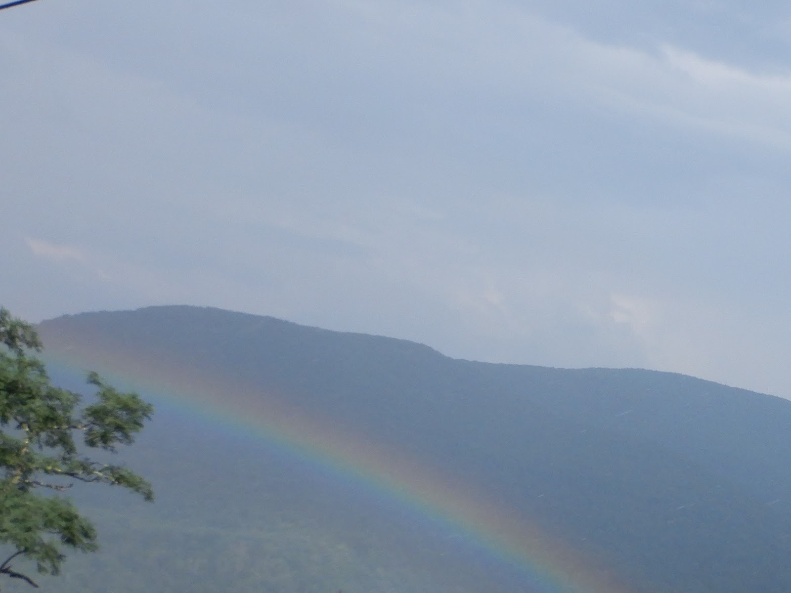
 From there we meandered back to DC, taking little back
roads, including more gravel, visited the smallest church in the lower 48 states
(according to its sign), the Jenning-Randolph Lake Dam, and like many of our
trips this summer, enjoyed a rainbow as we crossed the Shenandoah Valley on our
way home.
From there we meandered back to DC, taking little back
roads, including more gravel, visited the smallest church in the lower 48 states
(according to its sign), the Jenning-Randolph Lake Dam, and like many of our
trips this summer, enjoyed a rainbow as we crossed the Shenandoah Valley on our
way home.
No comments:
Post a Comment