The extremely long, last installment!
Tuesday, June 25: Houghton MI to Grand Marais MI
What a busy day this was!
Before leaving Houghton, we moseyed down to the Isle Royale National Park site in Houghton, which is actually just the jumping off point for the ferry to Isle Royale, to get our picture with the sign and a stamp.
 |
| In Houghton |
Then we headed out to explore the tip of the Keweenaw Peninsula which the the point of land that juts out into Lake Superior from the Upper Peninsula -- the peninsula on the peninsula.
Calumet included some very stunning stone buildings and a giant piece of float copper. Copper mining was the life blood of this region for many years. The town itself was charming, clearly striving to create "cute" from what was otherwise a town whose economic peak had ebbed.
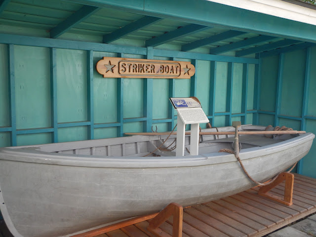
Leaving Calumet, we traveled Route 41 with stops at various roadside attractions -- a stone boat (a memorial to a boat), a giant thermostat that recorded the region's amazing snow falls, and a historic blacksmith's shop.
 |
| The stone boat |
 |
| 390.4 inches is a lot of snow! |
 |
| A blacksmith shop, open for display but no one around. |
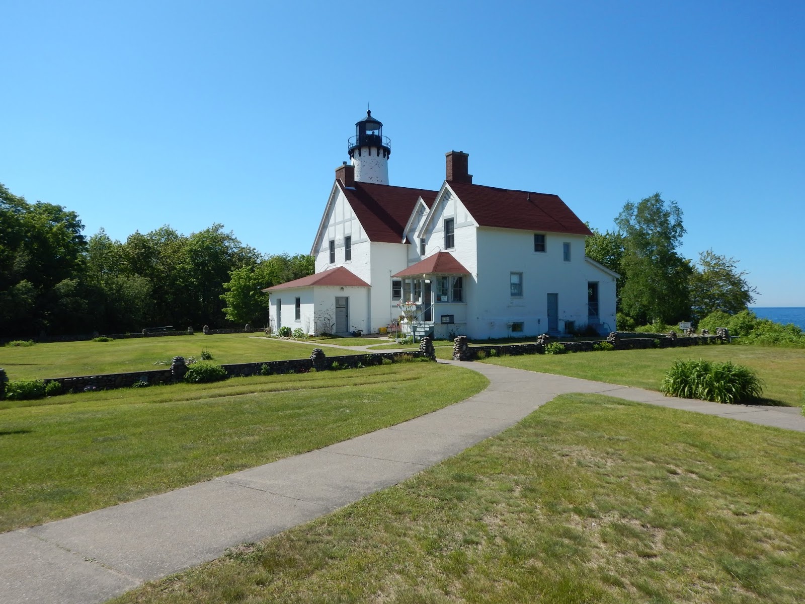
Eagle Harbor Lighthouse has a museum on-site, but both were still closed up when we arrived. We were not the only early-bird visitors. The lighthouse sits on a point of land with an absolutely stunning view of Lake Superior. I watched a man pick his way slowly down a rocky incline to dip his hand into the lake. A bit later I chatted with him and his wife and learned that they were visiting from Arizona and this was his first trip to the area. His wife, however, had grown up at this spot. Not just nearby. Her grandparents had been the lightkeepers! The man said that he had previously spent time riding the country on a motorcycle and seemed a bit envious of our trip. Another couple, also riders, stopped to chat about our trip too. They advised us to take the "high road" on our return so that we could enjoy some stunning views not available from Route 41.
Jeff and I don't go out of our way to chat with strangers, and we didn't have to on this trip either. People just walked up to us at random, everywhere we went, to talk motorcycles with us. I was beginning to think everyone over 60 who crossed our path had a motorcycle memory!
 |
| The lighthouse and museum |
 |
| Lake Superior |
I also spent an inordinate amount of time at the lighthouse watching a scurry of baby chipmunks. At first I saw one or two dart under the siding of the gift shop. After observing a bit, I think there were no fewer than six, tagging each other and scampering in and out of various gaps in the siding. They kindly piled up and posed for me on occasion.
We continued along Route 41 which starts near the tip of the Keweenaw Peninsula and ends in Florida. The sign at the end of Route 41 is a virtual geocache. Jeff noted that a far point at the end of the logging road beyond the end of Route 41 had been used as a bonus in a past ButtLite rally, but he had never been and didn't have it in the plan for today either.
The road took us through little hamlets, wooded areas and lovely coastal scenery.

I should pause here to remind readers that the Iron Butt Rally -- an 11-day endurance motorcycle event with bonuses located all over the USA and Canada -- was in progress. We had been watching the daily dramas unfold as riders departed from the starting point in South Carolina and then arrived at and left the first checkpoint in Washington State. Quite a few had endured safety-threatening snowy conditions and bone-chilling cold in their quest for "peak" bonuses (literally mountain top peaks). From the Washington State checkpoint, they had either headed north to Canada and Alaska or cruised the California coast. By June 25, the riders had either been through the return to the Washington State checkpoint and were now more or less heading to South Carolina or had opted to skip the second checkpoint in favor of gathering bonuses in far northern destinations. A great number of the IBR followers were wringing their hands in anxiety over a rider who appeared to be stranded in Homer Alaska, and speculating on his or her chances of finishing. Homer, as the rider had been dubbed, became the underdog everyone could love. Go, Homer, Go!
So, as Jeff and I rode down the isolated and mostly deserted tip of Route 41 that morning, we knew that many of our friends were working their way across the continent. But this stretch of Route 41 is literally a road to nowhere. It juts into Lake Superior, so when the paved road ends, you either turn and come back or take the logging road until it ends, and then turn and come back. It's not on the way between Washington and South Carolina, for sure.
Therefore, as we cruised the empty road, IBR was far from our minds. There were many other motorcyclists in the area, touring like us, but none we knew. Therefore, when Jeff saw an on-coming motorcyclist who seemed intent on stopping us, we were pretty puzzled. Jeff wasn’t sure why the motorcyclist was signaling us, but he pulled over. The rider, now past us, stopped too, did a multi-point turn and came up next to us.
“Be careful, go slow,” he warned us. He launched into a description of the logging road as really rough — the worse he’d ever been on. As he talked I’m noting the aux tank, the Klim gear, the Shoei helmet. I didn’t have a great view of his face or bike. But he sure didn't look like most of the other vacationing motorcyclists.
Jeff: “Thanks, but we’re not going that far.”
Rider (incredulous): “Then why are you here?”
Jeff: “We’re just goofing off. Sightseeing” Then, realizing .... “Wait! Are you in the rally?”
Rider (still puzzled): “Yes! Aren’t you?”
Jeff (who’s finished the IBR, twice) responded, laughing: “No we aren’t. And you need to get the fuck out of here! You don't have time to talk to tourists!”
As the motorcyclist pushed back to get underway, it seemed to me that his bike looked awfully familiar and I had a sudden inkling. "What's your name?" I asked. "Steve" he replied. Under gear, neither Jeff nor I are particularly good at recognizing people. But as he roared away, Jeff and I compared notes and confirmed my suspicion. Steve, on a Honda ST with Massachusetts plates. Steve Gallant! The rookie IBR rider who was in first place as of the first checkpoint! Steve of the Steve and Charlotte two-up who we had tagged for a bit in Void 2017 (finishing 5th to their 3rd). Oh my! The ButtLite bonus was now an IBR bonus and we had just stumbled into it! Sure enough, within the next hour, we saw several other bikes kitted up for a rally, not a vacation, heading out to the point.
We learned later that Steve had recognized us. (It's easier I find to identify a two-up; if Char had been with him, we would have figured it out sooner.) But although he stopped us, he was mystified by our presence. Since we weren't in the rally, were we there to spy on the riders attempting that bonus? It seemed the only logical explanation -- unless you know that we're crazy geocachers who ride to "nowhere" to take a picture. (That's almost as crazy as riding 11,000 plus miles in 11 days across a continent to score bonuses!)
 |
| The picture we were seeking -- at the beginning of Route 41. |
 |
| The paved roads weren't all that great either. |
 |
| Fortunately for the wildlife, traffic was pretty scarce. |
Our return trip via the "high road" indeed yielded the amazing views promised. It was also suppose to yield two geocaches but we only got one of them.
The next two stops were truly "Roadside America" gold (fool's gold, that is). We were suckered into them by geocaching, of course. Yooperland describes itself as a tourist trap and truly, it's only reason for existing is to offer people who have too many kids in the car a chance of relief. The area around the gift shop consists of a number of "exhibits" illustrating crazy and exaggerated "Yoopers" stereotypes. One or two actually have some historical significance, but that's a very small portion.
The next stop was Lakenland, a forested area with outdoor sculptures, mostly made of scrap. Of the two I think I would have preferred more time in Lakenland, but we had already wasted too much time trying to answer geocaching questions about Yooperland to linger long.
We stopped in Au Train for a Tour of Honor Memorial.
We then traveled through Pictured Rocks National Lakeshore, a lovely scenic area.
That brought us to Grand Marais, our stop for the night.
The town of Grand Marais is tiny, relaxed, and tourist friendly (in the summer). No boutiques, just some lodges, stores to stock up on groceries, and some simple eateries. And great views!

As we rolled through town, we scoped out our dining options and then made our way to a bluff at the far end of town. Voyagers Motel, a mom-and-pop place, was a few blocks off from the main drag, but very walkable. (And it was for sale.) The owner, Delphine, was very nice and made us welcome, although I was a bit surprised when she asked how I was enjoying my trip to the United States. After we established that the District of Columbia, which is where my license was issued, is not a foreign country, she showed us to our room and we discovered she even had a stash of plates to keep motorcycle kickstands from sinking into the gravel of the parking lot. The room was adequate and the view from the bluff was nice. We walked to the far side of town for dinner at the Dunes Saloon Lake Superior Brewing Co. It wasn't a long walk. The Dunes seemed to be quite the local hangout. The pizza was soggy but the beer was OK and we enjoyed the atmosphere. We had a nice stroll back past the Pickle Barrel House, enjoying the fresh breezes off the lake.

Wednesday, June 26: Grand Marais to LeLand, MI.
Up early, before the hotel office opened and no hair dryer. But there was a breeze outside so a short walk dried my hair sufficiently to put on a helmet. Breakfast, however, was a bit of a puzzle. The motel does not offer breakfast. We left the motel early and cruised the town, but nothing was open, not even a grocery store. Then we noticed both locals and tourists beginning to gather outside of a diner that we thought had gone "paws up."
But at 8 a.m. sharp, the lights came on and people began streaming in. We had an excellent breakfast, although a a much slower pace than we had expected or hoped, in a classic diner with a rustic-looking addition on the rear.
After our later than expected start, we began our journey off the peninsula. An early stop was at Whitefish Point to visit the oldest active lighthouse on Lake Superior (1849).
The site houses a Shipwreck Museum so I wasn't terribly surprised to see a shoreline memorial to the Edmund Fitzgerald. Remember the Gordon Lightfoot 1976 song (and will you now have an earbug all day because of that!)? I was surprised to learn the wreck occurred in 1975. I had just assumed it was ancient history.
Tahquamenon Falls was beautiful and colorful, but in a disturbing way. It's odd to see water in such shades of brown, beige, and ochre. But the colors are naturally occurring as a result of tannic acid.
Mission Hill Cemetery in Bay Mills Township yielded splendid views from the lookout and a walk through a historic cemetery. This too held reminders of the lives lost on "gichi-gami" (relabeled by Henry Wadsworth Longfellow as Gitche Gumee).


The lighthouse at Point Iroquois on Whitefish Bay was not nearly as imposing as the one at Whitefish Point, although it had some informative signage.
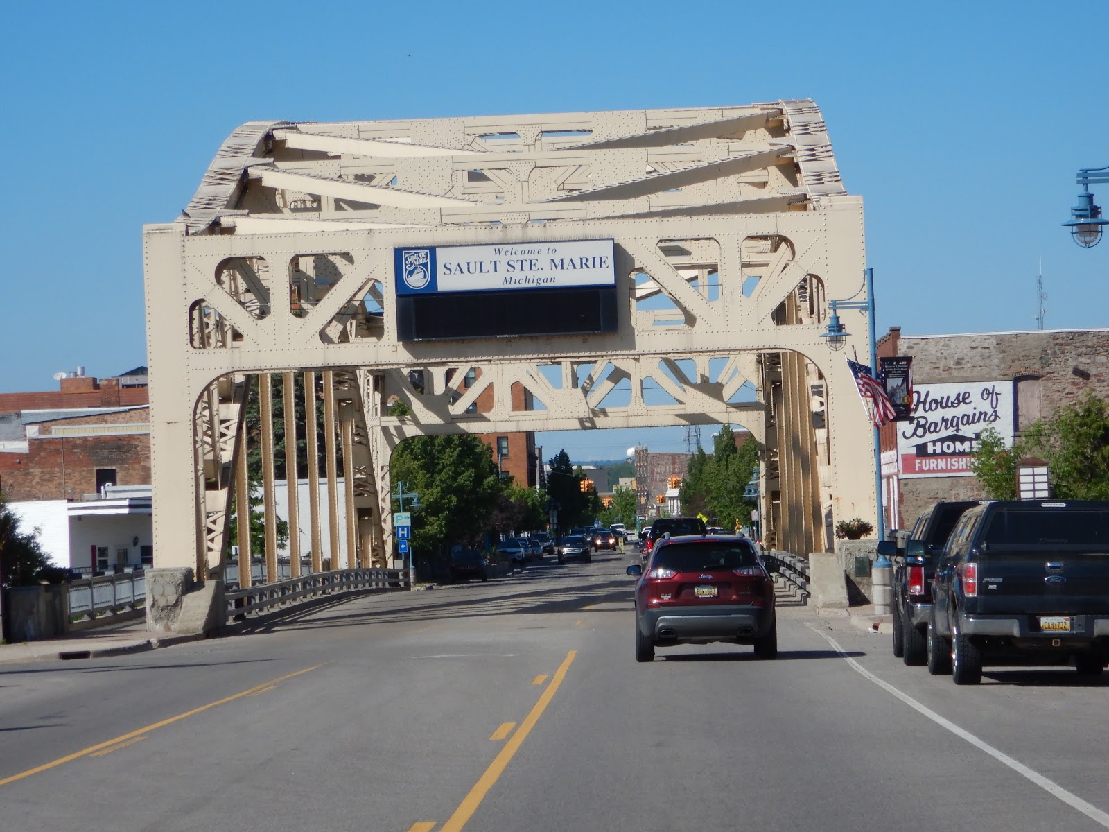
We spent a bit of time cruising the waterfront in Sault Ste. Marie, which has a number of military installations, a museum on a ship and a horrific example of brutalist architecture known as the Tower of History built on the site of Jacques Marquette's log cabin.

We departed the Upper Peninsula via the Mackinac Bridge and then rode pretty straight and hard south and slightly west through Traverse City and then north and west to Leland.
We arrived fairly late and found Leland Lodge, our resting spot for the night. The lodge was a cross between an aspiring luxury resort and a county inn that attracts the same people year after year. Trying to be fancy but in a small town way. It was situated on a golf course on the edge of a small town. The front desk closed at 9 p.m., before we arrived; but fortunately we arrived before 10, when the bar would close; so the bar staff showed us where to find our envelope that had the room key and a welcome letter in it. We ate at the Bluebird Tavern which was just a few blocks away. It was pretty good, friendly, and quite the town hangout. Then we wandered around a bit (geocaching of course) but saw a bit of the town including this very cool car. No, boat. No, car. Whatever!
Thursday, June 27: Leland to Port Huron MI
Breakfast at the Lodge consisted of coffee and chocolate chip muffin (which we could have supplemented with the chocolate chip cookies that had been left for us in our room the night before, if we had a mega dose of insulin with us!) Although a Hampton Inn breakfast would have been nice, the quaint inn was a lovely and almost luxurious respite from the chain hotels and mom-and-pop places we usually frequent.
We browsed a bit more though Leland on our way out of town in the daylight, but didn't linger long.
 |
| In Leland MI |
Our big event for the day was Sleeping Bear Dunes. The dunes overlook Lake Michigan, rising out of a lovely meadow and woodland area. We didn't climb the dunes (although it is permitted and sand-sledding is very popular), given that we were in full gear. It would have been tough to do in our boots, and we would have been uncomfortable all day with gear full of sand! But, we did enjoy a walk on the nature trail and the views from nearby lookout.
The rest of the day was a series of memorials and sights of one sort or another, as we worked our way across the state to Lake Huron and then to Port Huron MI, our stopping place for the night.
 |
| In Cadillac MI - hometown kids! |
 |
| Coleman MI |
 |
| Port Huron MI |
 |
| Rinsing off my hands after a sticky geocache in Lake Cadillac. |
We found a pretty good Mexican restaurant in Port Huron with patio seating which was perfect after our long day. Can't remember where we stayed that night -- so it must have been nondescript.
Friday, June 28: Port Huron MI to Cleveland, OH (Westlake suburb)
Port Huron has a bit of history to it, so we enjoyed starting our day there. Near the water's edge, we stopped at a train station, where young Thomas Edison launched his first business, selling candy and newspapers on the train, to earn money to buy chemicals.


There were various other sights (and geocaches) along the St. Clair river, including an old lightship. Large tankers were moving under the Blue Water Bridge from the river into Lake Huron. We chatted briefly with a commercial photographer who was following one with a drone.
We also found the site of the first international submarine railway tunnel.
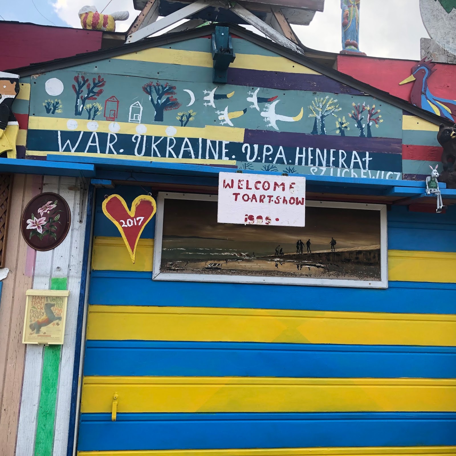
The next stop was truly one we would not have found but for Jeff's prior rally bonus-hunting. Hamtramck Disneyland is a folk art marvel by a man named
Dmytro Szylak located in an alley between two garages. I can't describe it. Just look at the pictures! And "Welcome to Art Show."
Detroit was pretty desolate. But we made our way through areas of boarded up buildings and abandoned warehouses to one special warehouse -- the home of Henry Ford's Piquette Plant, where Ford first piloted the idea of a moving assembly line. (The first truly moving assembly line was implemented when he moved the plant to bigger quarters in Highland Park. Models B, C, F, K, N, R, S and T were produced here. (You don't think he skipped from A to T, do you?). Even better, most of the alphabet was on display.
And some of the stuff in the parking lot was pretty cool too!
Onward to the Henry Ford Museum! This place was truly remarkable. Far beyond cars, this place had some of everything. We spend a couple of hours there, and really only had time to absorb a fraction of the material. We didn't even consider going to the "village" or the other sites that have made this a full-day tourist destination. A few favorites:
 |
| The glass collection was stunning. It was my first stop, of course! |
 |
| This house of the future was also stunning. A full, furnished model was available to walk through |
 |
| The Star Trek exhibit was fun, even if for non-Trekkies. Beam me up, Scotty! |
The Motown musuem was hosting a private event, but we passed by.
As we continued our journey toward Ohio, the rain moved in. But we got double, full-arch rainbows as compensation. (Unfortunately, none of my attempted photos did it justice.) A quick stop for Ohio's Merci boxcar, a NSP stamp at River Raison, and a few other things we were "collecting" on the trip, and then into Westlake, Ohio for the night.
Our hotel, another Hampton Inn perhaps (or if not, another chain), was near a shopping plaza so we walked over there for dinner. I know I must lead a sheltered life, but for the first time in my memory, I ate at a Cheesecake Factory. The food was very good.
Saturday, June 29: Westlake, Ohio to Home!
The last leg of our journey was uneventful. The James Garfield House and Cuyahoga Valley National Park were unexpectedly charming, we stopped to photograph various memorials and signs needed for some of our rallies, and the Flight 93 Memorial was as moving as always.
 |
| At the James Garfield House |
 |
| The James Garfield House - the museum was excellent! |
 |
| The Visitor's Center at the Boston Store area of Cuyahoga Valley National Park |
 |
| The new Tower of Voices at the Flight 93 Memorial |
And then we were home!